Share your scenic view.
Bring your coastline, harbor or mountain view to Port of Cams.
Explore camera hosting →

The aurora australis is the same light as the northern lights, seen from the other end of the planet. From Tasmania and the south of New Zealand it shows low over the southern horizon whenever a geomagnetic storm pushes the southern oval north from Antarctica. These cameras face it, or sit in the darkest places to look from.
The live planetary K-index loads from NOAA in your browser.
Roughly what puts aurora in Hobart’s sky on a dark, clear night. Higher Kp brings it overhead and brighter.
Tonight’s verdict compares NOAA’s Kp forecast for Hobart’s dark hours with the Kp needed here.
A dark live-video camera with the least cloud; a snapshot camera only when no video camera here is dark. Press play to watch it here.
Ranking the cameras by darkness and cloud…
Live video first, then snapshot cameras (still images that refresh every few minutes, including science all-sky cameras). Within each group: dark now first, then least cloud. “Dark” means the sun is more than 12° below the horizon at that camera; cloud is Open-Meteo’s current model value for the spot.
 Beaumaris, Tasmania (41.4°S) Beaumaris, north-east coast of Tasmania, Australia Live video Dark (sun below −12°): 8:51 PM GMT+11 – 4:56 AM GMT+11
 Lake Te Anau, Fiordland, NZ Te Anau, Fiordland, New Zealand Live video Dark (sun below −12°): 9:46 PM GMT+13 – 5:21 AM GMT+13
 Kina, Tasman, NZ (41.2°S) Kina, Tasman District, New Zealand Live video Dark (sun below −12°): 9:11 PM GMT+13 – 5:16 AM GMT+13
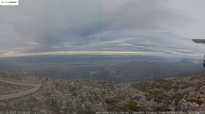 Wellington Park, Hobart, Tasmania Hobart, Australia Snapshot Dark (sun below −12°): 9:01 PM GMT+11 – 4:56 AM GMT+11
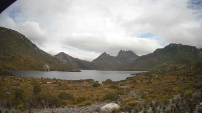 Cradle Mountain, Tasmania Tasmania, Australia Snapshot Dark (sun below −12°): 9:01 PM GMT+11 – 5:01 AM GMT+11
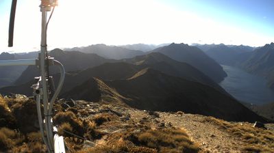 Kepler Track, Fiordland, NZ Fiordland Community, New Zealand Snapshot Dark (sun below −12°): 9:46 PM GMT+13 – 5:26 AM GMT+13
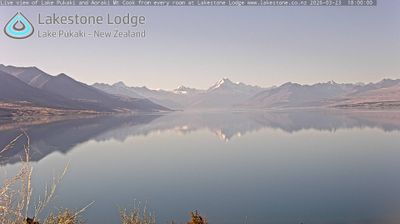 Lake Pukaki, Mackenzie Basin, NZ Twizel, New Zealand Snapshot Dark (sun below −12°): 9:31 PM GMT+13 – 5:16 AM GMT+13
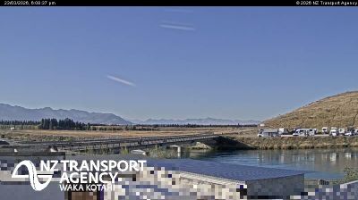 Twizel, Mackenzie Basin, NZ Twizel, New Zealand Snapshot Dark (sun below −12°): 9:31 PM GMT+13 – 5:16 AM GMT+13
The southern auroral oval circles the south geomagnetic pole, which lies off the Antarctic coast south of Australia. Tasmania and New Zealand’s South Island are the inhabited land closest to it, but they are still well north of the oval on a quiet night, so a display needs a geomagnetic storm. The same Kp index applies as in the north:
| Place | Latitude | Usually visible at |
|---|---|---|
| Stewart Island / Rakiura, Bluff, the Catlins | 46.5–47°S | Kp 4–5 |
| Te Anau, Queenstown, Dunedin | 45–45.9°S | Kp 5 |
| Southern Tasmania: Hobart, South Arm, Bruny Island | 42.9–43.5°S | Kp 5 |
| Lake Tekapo, Lake Pukaki, Twizel | 44–44.3°S | Kp 5–6 |
| North-east Tasmania, Cradle Mountain | 41–41.7°S | Kp 6 |
| Christchurch | 43.5°S | Kp 6 |
| Nelson, Melbourne | 37.8–41.3°S | Kp 7 |
Tasmania does better than its latitude suggests, because the south geomagnetic pole leans toward Australia: Hobart at 43°S has about the same geomagnetic latitude as Te Anau at 45°S, and only Stewart Island is clearly better placed. On most storm nights the aurora australis is a glow and pillars low in the south, often more obvious to a camera than to the eye. In the biggest storms of 2024 it rose high over both islands and was seen from the Australian mainland and New Zealand’s North Island.
The Australian Antarctic Division’s station webcams at Mawson, Davis and Casey often show aurora in the southern winter, but their terms allow only personal, non-commercial use, so they are not embedded here.
Season: the southern lights can appear in any month, but the long nights from April to September give the most dark hours, and the March and September equinoxes bring the most geomagnetic activity. In December the nights are short: at Te Anau the sun is not 12° below the horizon until after 23:00.
Time of night: from full dark to about 02:00 local time is the most active stretch, but in a storm the display follows the storm’s timing, not the clock. Check the storm banner and the cameras rather than waiting for midnight.
In Tasmania, anywhere with a clear view south over water: South Arm and Opossum Bay, Goats Bluff, the beaches of Bruny Island, or Cockle Creek at the end of the road. In palawa kani, the language of Tasmanian Aboriginal people, the aurora is nuyina, the name given to Australia’s Antarctic icebreaker. In New Zealand, where it is Tahunui-a-rangi in te reo Māori, the favourites are Stewart Island / Rakiura, a Dark Sky Sanctuary; Curio Bay and the Catlins coast; the Otago Peninsula above Dunedin; and the Mackenzie Basin around Lake Tekapo, where Mount John Observatory runs night tours.
Australia’s Bureau of Meteorology Space Weather Services issues aurora alerts and watches for the region, and the cloud figure on each camera above is the current model value for that spot. Southerly fronts bring both cloud and clearances; the gap behind one is often the night.
Kp: NOAA Space Weather Prediction Center. Cloud: Open-Meteo. Camera feeds belong to their operators, named on each camera page.
Sell tickets for the room. Make a plan to stream your next show beyond it.
Try another place or clear your filters.
Bring your coastline, harbor or mountain view to Port of Cams.
Explore camera hosting →Plan cameras, mixer audio and a ticketed livestream. Onsite installation or remote-assisted setup, scoped for your venue.
Plan a concert livestream →