No matching pages. Try a place, activity, or tool name.
NORTH SHORE WINTER · LIVE SWELL OUTLOOK
Hawaii Big Wave Season: Live Cams for Pipeline, Waimea and Jaws
From about November to March, storms in the North Pacific send long-period swells to the north shores of Oʻahu and Maui. This page shows which of the next seven days look big for the North Shore and for Peʻahi, the live Pipeline cam to watch them on, and what to look for before you drive out.
Tuesday, October 27 at 9:08 AM HST·Mornings on the North Shore usually bring the lightest wind of the day, and the best time to watch.
Swell outlook, next 7 days
North Shore: the biggest daylight swell in the next seven days is Mon Nov 2, 11 ft at 10 s from the NNW (rough). No day reaches our Big tier (10 ft at 13 s from the open window). Peʻahi: the biggest daylight swell in the next seven days is Mon Nov 2, 10.4 ft at 10 s from the NNW (rough). No day reaches our Big tier (10 ft at 13 s from the open window).
North Shore, Oʻahu Pipeline, Waimea Bay, Sunset Beach
Today Oct 27Moderate4.7 ft · 12 s · NWAM wind: LightSunrise 6:34 am
Wed Oct 28Moderate3.7 ft · 10 s · NWAM wind: ENE 12 mph, cross-shoreSunrise 6:34 am
Thu Oct 29Small2.4 ft · 10 s · NWAM wind: ENE 11 mph, cross-shoreSunrise 6:35 am
Fri Oct 30Small4.2 ft · 7 s · NNEwraps inAM wind: ENE 11 mph, cross-shoreSunrise 6:35 am
Sat Oct 31Small4.1 ft · 7 s · NNEwraps inAM wind: ENE 9 mph, cross-shoreSunrise 6:36 am
Sun Nov 1Moderate5.8 ft · 15 s · NNWAM wind: NE 7 mph, cross-shoreSunrise 6:36 am
Mon Nov 2Rough11 ft · 10 s · NNWAM wind: NE 12 mph, cross-shoreSunrise 6:37 am
Peʻahi (Jaws), Maui Jaws and Maui’s north shore
Today Oct 27Moderate3.9 ft · 13 s · NNWAM wind: LightSunrise 6:26 am
Wed Oct 28Moderate3.5 ft · 10 s · NNWAM wind: N 5 mph, onshoreSunrise 6:27 am
Thu Oct 29Small4.3 ft · 7 s · NNEAM wind: ENE 12 mph, side-onshoreSunrise 6:27 am
Fri Oct 30Small4.1 ft · 7 s · NNEAM wind: ENE 12 mph, side-onshoreSunrise 6:28 am
Sat Oct 31Small4 ft · 6 s · NNEAM wind: E 11 mph, side-onshoreSunrise 6:28 am
Sun Nov 1Moderate5.2 ft · 15 s · NNWAM wind: NE 5 mph, onshoreSunrise 6:29 am
Mon Nov 2Rough10.4 ft · 10 s · NNWAM wind: NNE 11 mph, onshoreSunrise 6:29 am
Each day shows the largest swell in daylight (6 am to 6 pm HST) that reaches that coast: the model’s deep-water swell height, its period and the direction it comes from, picked from the primary and secondary swell by energy. A swell that only wraps in from the side counts at half its height. Highlighted days reach our Big tier. The morning wind is the 6–10 am average and how it blows relative to the shore.
What the tiers mean
Giant
20 ft or more at 15 s or longer. Swell height at the 20 ft open-ocean mark The Eddie waits for.
XL
15 ft or more at 15 s or longer. Outer reefs and Waimea Bay can break.
Big
10 ft or more at 13 s or longer. Big-wave day: Pipeline’s outer reefs and Sunset can come alive.
Solid
6 ft or more at 12 s or longer. Solid winter surf on the exposed reefs.
Rough
8 ft or more. Big but short-period: mostly wind swell, usually messy.
Moderate
3 ft or more at 8 s or longer. Surfable, nothing heavy.
Small
Small, short-period, or from the wrong direction for this coast.
This is our rule of thumb for which days are worth watching, not an official scale or a surf report.
Computed when this page was built on Tuesday, October 27 at 9:08 AM HST from Open-Meteo’s marine model. Your browser refreshes it from Open-Meteo.
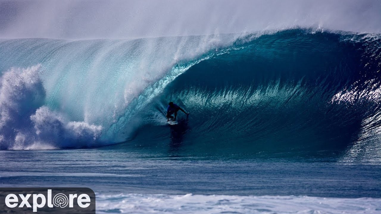
What you see: A live YouTube stream aimed at the Pipeline reef off ʻEhukai Beach. On a north or west-northwest swell you can watch the sets stand up on the reef and pitch into the barrels the break is known for; on a small day it is a calm stretch of water and a shorebreak.
Best time: Sunrise to late morning HST, roughly 7–11 AM, while the wind is usually lightest. In winter the afternoon sun sits low in the southwest, which can put glare on the water.
What you see: NOAA’s GOES-West satellite view of the islands and the ocean around them. It does not show waves, but it shows the weather that comes with a winter swell: a cold front’s cloud band sweeping down from the northwest, or clear skies and trade-wind clouds on the days in between.
Best time: Any time; visible-light frames are clearest in daylight HST.
There is no live camera at Waimea Bay, Sunset Beach or Peʻahi (Jaws) on Port of Cams right now. We only list cameras we have checked, so this page does not stand an unrelated beach cam in for them. For every Hawaii surf camera, including the south shore and Maui, see Hawaii surf cams.
What makes a big day
Period matters more than height. The period is the time between waves, and it tells you how much energy a swell carries and how far it has travelled. A 6-foot swell at 8 seconds is wind swell from not far away; the same height at 16 seconds comes from a storm thousands of miles away and stands up into much bigger waves when it hits the reef. On the North Shore, 14 seconds or more is the sign of a real winter swell.
Direction decides who gets it. The North Shore of Oʻahu faces north-northwest, so swells from the west-northwest round to the north hit it squarely. Northeast swells wrap in weakly, and south swells, which light up Waikīkī in summer, do not reach it at all. Peʻahi on Maui faces north and wants the same northwest-to-north swells.
Wind decides whether it is clean. The trade winds blow from the east-northeast most days. At Pipeline that is a cross-shore wind, and it tends to strengthen through the day, which is why mornings are usually cleaner. A day with light wind, or a wind with some south or east in it, is a good day to be watching.
Reading the buoys
The forecast is a model; the buoys measure what is actually in the water. NOAA’s National Data Buoy Center publishes each buoy’s readings every half hour or so: WVHT is the significant wave height in metres (multiply by 3.28 for feet), DPD the dominant period in seconds and MWD the direction the waves come from. Watch for the period jumping up first: the longest-period waves of a new swell outrun the rest, so a rise from 8 to 17 or 18 seconds is the first sign that a winter swell has arrived.
Buoy 51101, NW Hawaii: About 220 miles northwest of Kauaʻi, in the path of northwest swells: a swell shows here first.
Buoy 51201, Waimea Bay, Oʻahu: A CDIP wave buoy (station 106) just off Waimea Bay: what is arriving on the North Shore now.
Buoy 51205, Pauwela, Maui: A CDIP wave buoy (station 187) off Maui’s north shore, about 10 miles from Peʻahi.
Because long-period waves travel faster, you can estimate when a swell seen at buoy 51101 reaches the Waimea Bay buoy, about 310 miles to the southeast. In deep water a swell’s energy moves at roughly 0.78 metres per second for every second of period:
Swell period
12 s
14 s
16 s
18 s
20 s
51101 to Waimea Bay
about 15 h
about 13 h
about 11 h
about 10 h
about 9 h
That is a guide for a northwest swell; a swell from further north reaches 51101 at a different angle. The National Weather Service in Honolulu issues High Surf Advisories and Warnings for north-facing shores when big surf is forecast, and those are the official word.
The spots
Banzai Pipeline
Off ʻEhukai Beach Park, Pūpūkea, North Shore of Oʻahu
Season: Breaks through the winter, usually from October or November into March; the biggest, cleanest days tend to come December to February.
Pipeline is a left that breaks over a shallow, flat lava reef a short paddle from the sand, which is what makes it so hollow and so dangerous. A west-northwest swell favours the left; a more northerly swell turns the peak into an A-frame and opens up Backdoor, the right. When the swell gets bigger the waves start breaking further out, on what surfers call Second and Third Reef. The Pipe Masters and other professional contests run here in winter, on dates that move from year to year.
Between Haleʻiwa and Pūpūkea, North Shore of Oʻahu
Season: Only breaks as a big-wave spot a few times each winter, on the largest north-northwest swells.
Most of the year Waimea is a swimming beach. On the few days a winter a giant swell arrives, the point at the north side of the bay starts breaking and it becomes the place big-wave surfing grew up. The Eddie Aikau Big Wave Invitational is held here only when open-ocean swells reach about 20 feet, which in the bay means faces of roughly 30 to 40 feet; it has run eleven times since 1984, most recently in December 2024, and the 2025–26 window passed without a call. The invitational’s window opens in early December each winter, but whether and when it runs is decided by the ocean.
Season: October or November to March, on west-northwest to north swells.
A long, shifting, powerful peak that breaks a long way out from the beach, and one of the venues of the Triple Crown of Surfing, the series of North Shore contests run at Haleʻiwa, Sunset and Pipeline since 1983. The paddle out is long and the currents strong; from the beach it is one of the better places to watch big lines of swell wrap in.
Maui’s north shore, about three miles east of Pāʻia
Season: Breaks on large north-northwest swells, mostly December to March.
An outer reef a few hundred feet off the cliffs that only breaks on big swells, when its waves can exceed 60 feet. It is where tow-in surfing was developed, and later where big-wave surfers proved it could be paddled. There is no beach: people watch from the overlook at the end of Hahana Road, a mostly unpaved road where four-wheel drive is recommended, or about a mile and a half on foot. Contests there have used long waiting periods, because the day cannot be set in advance.
Stand well back. On big days the sets surge far up the sand at Waimea, Pipeline and Sunset and can knock people off their feet and drag them in. Stay behind lifeguard signs and ropes, keep children close, and never turn your back on the ocean.
Treat closures and warnings as final. When a High Surf Warning is up, lifeguards close beaches and the water is for experienced big-wave surfers and rescue crews only. Pipeline breaks over shallow reef, and strong currents run along the whole coast.
Plan for traffic. Kamehameha Highway is the one road along the North Shore and it backs up for miles on big-swell and contest days. Park only in marked spaces, never stop on the highway to look, and walk on the shoulder with care. Slope-stabilization work began beside the highway at Waimea Bay in March 2026 after landslides (per Wikipedia’s Waimea Bay article), so expect work zones there.
At Peʻahi, the view is from the cliffs. There is no beach; spectators watch from an overlook on 100 to 150-foot cliffs at the end of a rough, mostly unpaved road. Stay back from the edge, and respect any closure of the road or the land it crosses.
Be a good guest. These are neighbourhoods first. Keep driveways clear, take your rubbish with you, and give lifeguards, photographers on the sand and the surfers’ families room.
Contest dates change every winter and some events only run when the waves allow. For the professional contests at Pipeline, check the World Surf League; for the history of The Eddie and the Triple Crown, the linked Wikipedia articles keep a record of when each ran.
Questions
When is big wave season in Hawaii?
On the north-facing shores of Oʻahu and Maui it runs through the northern winter, usually from October or November into March, when storms in the North Pacific send long-period swells south to the islands. The biggest and most frequent swells tend to come between December and February. In summer the North Shore is usually flat and the surf is on the south shores instead.
How big does it have to be for The Eddie to run at Waimea Bay?
The Eddie Aikau Big Wave Invitational waits for open-ocean swells of about 20 feet, which translate to wave faces of roughly 30 to 40 feet in the bay. Its holding window opens in early December, but it has only run eleven times since 1984, most recently on December 22, 2024. If the swell never arrives, there is no contest that winter.
What swell makes the North Shore big?
Size alone is not enough: the swell needs a long period and the right direction. A swell from the northwest or north with a period of 14 seconds or more carries far more energy than a short trade-wind swell of the same height, and it is what lights up Pipeline, Sunset and, on the biggest days, Waimea. Swells from the northeast wrap in weakly, and south swells do not reach the North Shore at all.
Is there a live cam at Waimea Bay or Jaws?
Not on Port of Cams at the moment. Our live North Shore camera is the Banzai Pipeline cam. We do not list a camera until we have checked that it streams, so this page links the Pipeline cam and the satellite view rather than standing in an unrelated camera for Waimea, Sunset or Peʻahi.
Is the swell forecast on this page the wave height at the beach?
No. It is the model’s deep-water swell height, the average height of the larger waves out in the open ocean. Breaking waves on a reef can be much bigger than that on a long-period swell (a 20-foot open-ocean swell can make 30 to 40-foot faces at Waimea), and locals often call wave size in Hawaiian scale, which reads roughly half the face height. Use the tiers as a guide to which days are worth watching, and the buoys and cameras for what is actually happening.
Swell and wind forecast: Open-Meteo marine and weather models (CC BY 4.0). Buoys: NOAA National Data Buoy Center. Sunrise and sunset: computed with SunCalc. Spot and contest facts checked against the linked sources on October 22, 2026. Camera feeds belong to their operators, named on each camera page.
THE WORLD IS ALWAYS ON.
A WINDOW TO SOMEWHERE ELSE
Start somewhere:
POCTIX · FOR VENUES & ORGANIZERS
Bring your stage to audiences everywhere.
Sell tickets for the room. Make a plan to stream your next show beyond it.
We use cookies for analytics and ad personalization. Decline keeps the site working;
Accept helps us improve and supports our free streams.
Learn more.