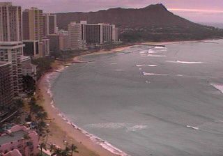
1 Lewers Street, Waikīkī (our camera)
Lewers Street, Waikīkī
Live videoPort of Cams (our own camera)
Our own camera: street life, palms in the trades and cloud on the ridges, day and night.


Tuesday, November 10 at 4:22 PM HST
Daylight on Oʻahu.
About the same on both sides right now.
Overcast · 79°F · 89% cloud
Next 6 h: no rain.
Wind ENE 14 mph.
Partly cloudy · 78°F · 47% cloud
Next 6 h: no rain.
Wind ENE 13 mph.
Partly cloudy · 77°F · 79% cloud
Next 6 h: no rain.
Wind ENE 14 mph.
Open-ocean waves: off the North Shore 6.8 ft from the NNE at 9 s; off Waikīkī 4.0 ft from the SE at 8 s (model, not breaking surf).
Open-Meteo, 4:15 p.m. HST; showers are local, so check the cams.
Coastline © OpenStreetMap contributors. Interactive map

Hawaiʻi time; offline cameras drop to the bottom.
The sheltered south shore, in the lee of the Koʻolau range. One of these cameras is ours.
Lewers Street, Waikīkī
Live videoPort of Cams (our own camera)
Our own camera: street life, palms in the trades and cloud on the ridges, day and night.
Waikiki Beach Marriott, Kalākaua Avenue
Live videoOzolio for Waikiki Beach Marriott Resort & Spa
Over the Kūhiō Beach walls and the surf breaks to the hotels and the pink Royal Hawaiian.
Western Waikīkī, Honolulu
SnapshotWindy.com webcam
The whole beach to Diamond Head, as a day-long time-lapse in Windy’s player.
Winter swells hit the North Shore; the windward coast gets the trade-wind showers.
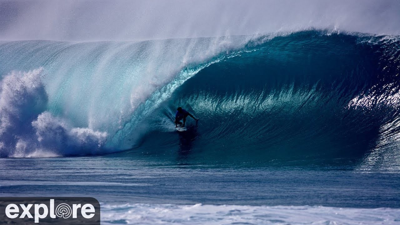
ʻEhukai Beach Park, Pūpūkea, North Shore
Live videoexplore.org
The Pipeline reef live: barrels on a winter swell, flat water in summer.
Lāʻie, on the windward coast near Oʻahu’s northern tip
SnapshotFAA WeatherCams
An FAA still camera, refreshed every 5–10 minutes: cloud and rain on the windward side.
We don’t carry the state’s freeway cameras; these do:
Trade winds drop their rain on windward coasts; leeward areas tend to be sunny and dry (NWS). NOAA’s 1991–2020 averages:
| Station | Year · Dec–Feb · Jun–Aug |
|---|---|
| Honolulu International AirportLeeward (south) | 16.41 in · 5.96 in · 1.86 in |
| WaikīkīLeeward (south) | 20.65 in · 7.44 in · 2.01 in |
| KāneʻoheWindward (east) | 50.90 in · 15.44 in · 8.37 in |
| Waimea ValleyNorth Shore | 52.02 in · 14.18 in · 10.68 in |
Kāneʻohe gets about 3 times the rain of Honolulu International Airport.
Sources: NWS Honolulu: Climate of Hawaii · NOAA NCEI U.S. Climate Normals, 1991–2020 (USW00022521, USC00519397, USC00513117, USC00519603)
Daylight in Hawaiʻi, which has no daylight saving.
| Waikīkī, the 15th | Sunrise · sunset (HST) |
|---|---|
| December | 7:02 a.m. · 5:53 p.m. |
| January | 7:12 a.m. · 6:11 p.m. |
| March | 6:41 a.m. · 6:41 p.m. |
| June | 5:50 a.m. · 7:15 p.m. |
| September | 6:19 a.m. · 6:36 p.m. |
Yes, two: the Waikiki Beach Marriott’s camera looks west along the beach, and a Windy.com camera looks east to Diamond Head. Our own Lewers Street camera is a block inland.
Usually the leeward side, Honolulu and Waikīkī: NOAA’s normals give Honolulu Airport 16.41 inches of rain a year against 50.90 at Kāneʻohe. The panel near the top shows today’s forecast.
GoAkamai, the state’s own traffic site, has Oʻahu’s freeway cameras. On Port of Cams there is an Oʻahu road conditions loop; we don’t carry the HDOT cameras ourselves.
In winter, usually November to March, when North Pacific storms send swell to the North Shore. Our big wave season page has the 7-day outlook.
Hawaiʻi Standard Time (UTC−10) all year, with no daylight saving. The clock at the top of this page shows it.
Feeds belong to their operators. Weather: Open-Meteo. Climate: NWS and NOAA NCEI. Traffic: GoAkamai.
Sell tickets for the room. Make a plan to stream your next show beyond it.
Try another place or clear your filters.
Bring your coastline, harbor or mountain view to Port of Cams.
Explore camera hosting →Plan cameras, mixer audio and a ticketed livestream. Onsite installation or remote-assisted setup, scoped for your venue.
Plan a concert livestream →